Proper navigation tools, along with a bit of know-how, can mean the difference between life and death out on the water. If disaster ever strikes, it pays to be prepared. But even on the most clear and relaxing day on the yacht, you’ll rely on certain essential navigation tools.
In this article, we’re highlighting a bunch of useful marine navigation tools to consider bringing on board:
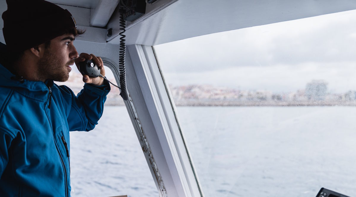
VHF Radio
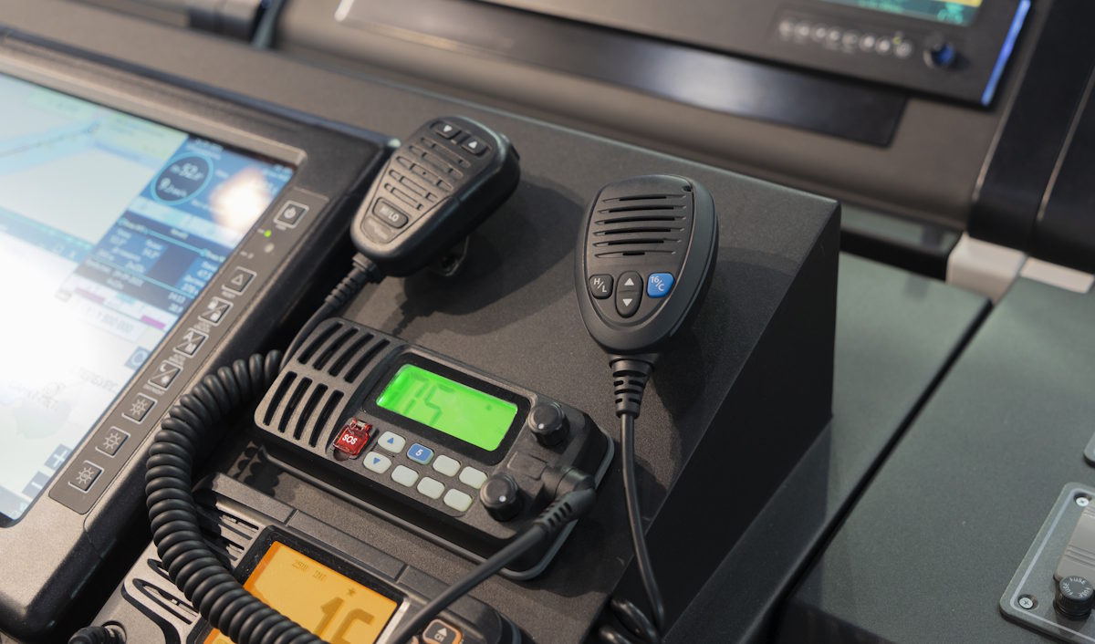
Having a VHF radio on board, which stands for very high frequency, is one of the mandatory navigation tools you’ll need to have. This radio allows for two-way radio communication between you and other vessels out on the way and shore stations. You’ll need this radio to communicate with marinas, bridges, and the Coast Guard, plus it could be used to ask other boaters out there to save your bacon in an emergency.
Channel 16 is the international designated channel for safety, which is monitored by the authorities and other boaters. This radio is also useful for hearing weather forecasts and other weather-related information.
GPS
Having a global positioning system (GPS) is another essential item to have on board for navigation. Using a process called triangulation, it works by talking to satellite-based systems orbiting Earth, which are able to relay info about location, distance, and speed.
GPS is frequently used in digital navigation tools like a chart plotter. These tools will have GPS built in, which then feed you important info about your boat and its surroundings. This makes GPS essential for accurate positioning, emergency response, and route planning.
Depth Sounder
Also known as an echo sounder or depth finder, the depth sounder is crucial for knowing what’s going on below the waterline. This marine navigation tool relies on sonar, or Sound Navigation and Ranging, a technique that employs sound waves to identify objects and distance underwater.
The depth sounder will help you spot major obstructions like rocks and areas with minimal depth to avoid. Some depth sounders will even identify fish!
Binoculars
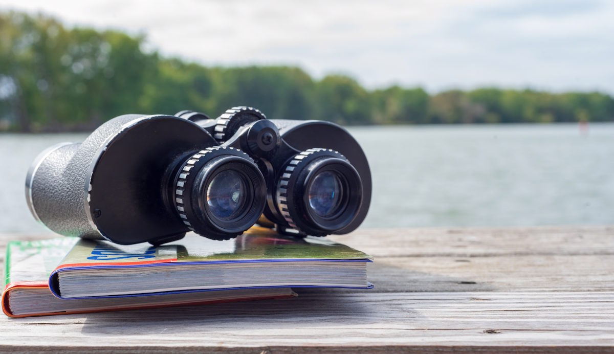
Binoculars are what will allow you to see what’s going on in the distance. This handheld tool works using two refracting telescopes mounted side-by-side and perfectly aligned to point in the same direction, allowing boaters to view distant objects like ships, islands, and infrastructure.
Binoculars are tried and true technology that’s been relied upon for literally hundreds of years. There were several developments over the years, but by World War 1, they were completely practical and essential. You can buy specific binoculars built for the marine world, but really any pair will do.
Electronic Navigation Chart
The electronic navigational chart (ENC) is a digital, vector-based database that appears on some kind of display on board. The display will show a detailed digital representation of a specific geographical area along with important data like ship positioning and collision/grounding avoidance.
Having an ENC makes navigation a breeze, because your position and surroundings are updated in real-time. This tool should be your primary method of navigation.
Flares
Flares are pyrotechnic distress signals used to attract attention with visual signals during times of emergency. Flares work thanks to a chemical mixture that produces either an extremely bright light, smoke, or both.
Portable, hand-held flares can be purchased that can be ignited quickly and easily, which are perfect for the boat. In fact, it’s mandatory to carry flares on board in certain regions of Canada. Make sure to store them in a cool, dark place, and mind the fact that they typically expire a few years after manufacturing.
Waterproof Flashlight
In the event of an emergency and the lights on your boat aren’t working, having a waterproof flashlight is essential. Plus, they’ll come in handy below deck, on the dinghy, or on shore.
For a relatively low price, you can purchase a waterproof flashlight from a number of places. When you do, be sure to check the IPX rating, which indicates how well the flashlight is protected against water penetration.
Paper Charts
We hope you never have to use them, but paper charts could be your only option to steer your boat to safety in the event of an emergency. Without GPS or Electronic Navigation chart, the paper charts could be all you’ve got.
These charts will give you accurate readings for water depths, plus key navigation aids like physical hazards. Seabed type, shoreline characteristics, anchorages, and landmarks could all be included in paper charts.
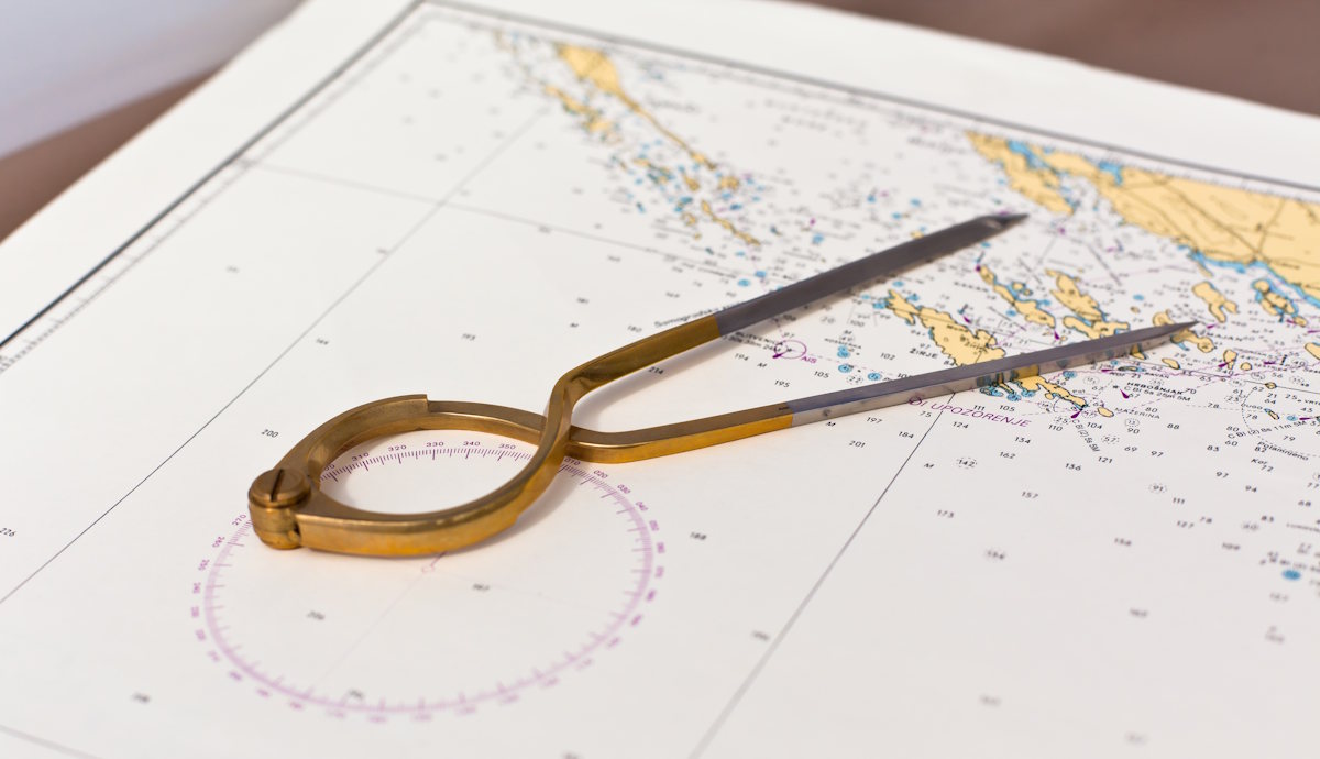
Dividers
Going hand-in-hand with your paper charts, dividers are a manual tool made with sharp, adjustable legs that are hinged together at the top. This is the tool you’ll use to measure, transfer, and mark off key distances.
Using a scale to get measurements, your dividers can be used on charts to map distances between two points, which becomes essential when GPS or electronic charts are down for whatever reason.
Radar
Radio Detection and Ranging, also known as Radar, is a navigational system that uses radio waves to give you readings on distances, directions, and speed. Even important objects like buoys, rocks, and other vessels will be picked up by radar. As you can imagine, this navigational tool becomes extremely important in conditions with limited visibility.
Whether in the dark or under harsh conditions of fog, rain or snow, your marine radar will show little blips or dots along with distances measured in nautical miles. This will be your primary tool for avoiding a collision in trying times.
Magnetic Compass
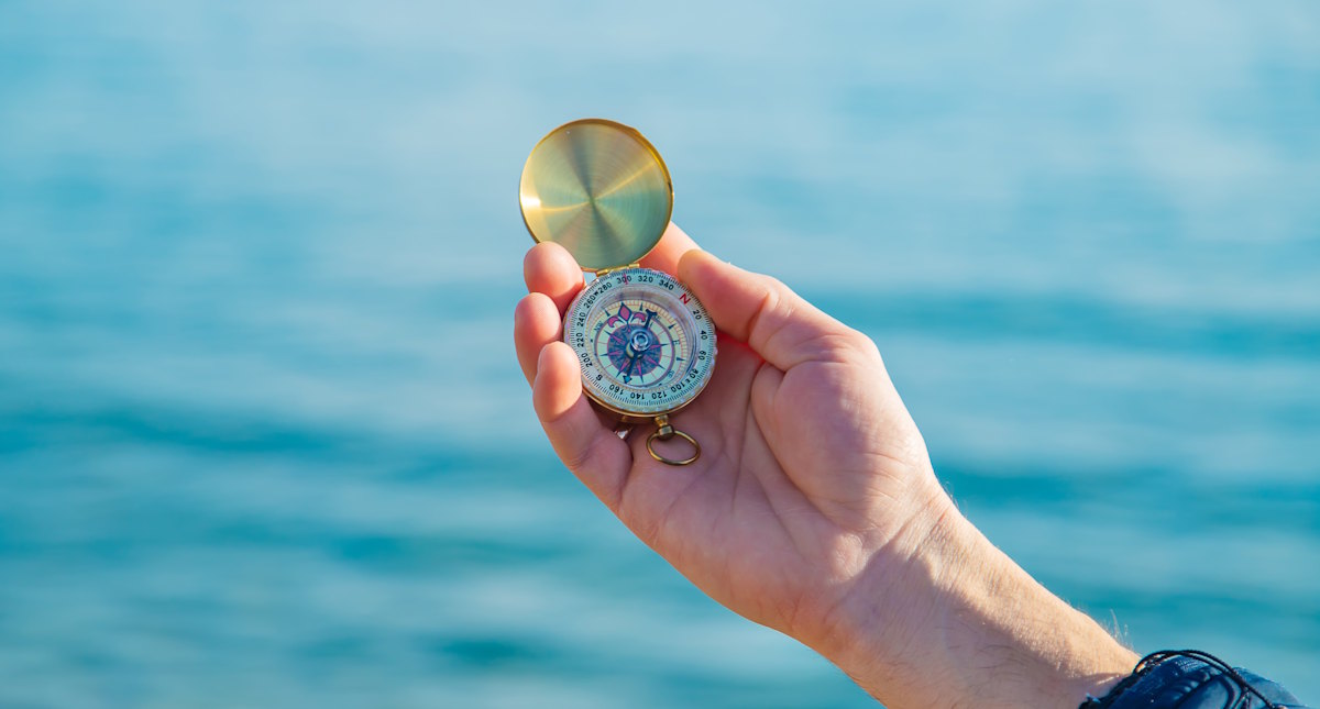
The compass is another old-school navigational tool that works without power and in any weather conditions, making it vital to have one on hand. In times of need, the compass can quickly tell you in the direction you’re headed.
The compass works by using magnetization in the needle, allowing it to align itself with the Earth’s magnetic field. The free-to-rotate needle will always point towards the magnetic north.
The navigational tools mentioned in this article should live on every boat, whether you’re completely new to boating or a seasoned veteran of the waters. Either way, you can always rely on the team at Van Isle Marina for guidance. Plus, we’ve got a fuel dock store where you can stock up on essentials like charts, tide books, and other supplies.

